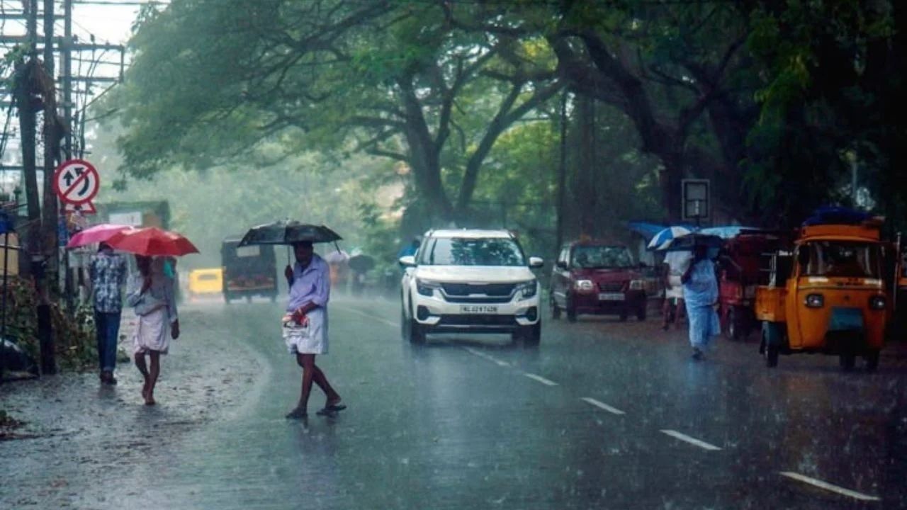
Monsoon exit takes an unexpected turn as heavy rain and thunderstorms threaten several parts of India. (Img: X)
New Delhi: The southwest monsoon is entering its withdrawal phase, but several parts of India are facing another spell of unsettled weather, with heavy rain, thunderstorms, lightning and strong winds forecast across 12 states. The weather shift is trending because wind speeds could reach up to 65 kmph in some areas, while hill districts face a risk of landslides and road disruption.
Delhi, Uttar Pradesh, Bihar, Madhya Pradesh, Rajasthan, Uttarakhand, Himachal Pradesh, West Bengal, Kerala, Jammu and Kashmir, Punjab and Jharkhand are among the regions expected to see rain and storm activity. The sudden change is being linked to active weather systems over the southwest Bay of Bengal and northeastern India.
The withdrawal of the southwest monsoon does not mean that rain suddenly stops across the country. During the transition period, atmospheric circulation, moisture movement and developing weather systems can continue to trigger showers and thunderstorms.
A cyclonic circulation is active over and around the southwest Bay of Bengal, while another circulation is influencing Sikkim and nearby areas. These systems are helping maintain moisture and atmospheric instability over several regions.
As a result, isolated heavy showers, thunderstorms, lightning and gusty winds can develop even in areas where the monsoon is already weakening.
The combination of intense rain and strong winds may affect visibility, road conditions, traffic movement and outdoor activities. Low-lying areas could also experience temporary waterlogging during intense spells.
The affected regions include Delhi, Uttar Pradesh, Bihar, Madhya Pradesh, Rajasthan, Uttarakhand, Himachal Pradesh, West Bengal, Kerala, Jammu and Kashmir, Punjab and Jharkhand.
The intensity will vary from one location to another. Some areas may receive light or moderate rain, while isolated districts could experience heavy showers accompanied by thunderstorms, lightning and strong winds.
The situation is particularly important in mountainous areas. Heavy rainfall on steep slopes can increase the possibility of landslides, falling debris and temporary road blockages.
## Delhi weather: Rain and thunderstorms may return
Delhi may experience cloudy conditions, rain and thunderstorms during the latest weather spell. Strong wind gusts during storms could affect traffic, visibility and outdoor movement.
The national capital is expected to record a maximum temperature of around 35 degrees Celsius, while the minimum temperature may remain close to 24 degrees Celsius.
The weather could change quickly during thunderstorm activity, making it important for commuters to monitor local weather updates before travelling.
## Uttar Pradesh weather: These districts need attention
Uttar Pradesh is among the states likely to see significant weather activity. Balrampur, Gorakhpur, Kanpur, Sitapur, Kushinagar, Siddharthnagar, Ghaziabad, Prayagraj, Meerut and Agra are among the districts mentioned in the forecast.
Thunderstorms and rain could be accompanied by winds of around 40 kmph in some areas.
Lucknow may record a maximum temperature of about 34 degrees Celsius and a minimum temperature near 24 degrees Celsius.
Heavy showers could lead to waterlogging in low-lying areas, while gusty winds may affect traffic, local transport and outdoor activity.
## Bihar weather: Thunderstorms and lightning likely
Several districts of Bihar may also experience rain and thunderstorms. Gopalganj, Kishanganj, Samastipur, Bhagalpur, Purnia, Araria, Begusarai, Saran, Siwan, Vaishali, Supaul, Gaya and Champaran are among the areas under the weather watch.
Patna may see a maximum temperature of around 33 degrees Celsius and a minimum temperature close to 24 degrees Celsius.
Lightning is a major concern during thunderstorms. People outdoors should move to a safe enclosed location when thunder activity increases and avoid isolated trees and exposed areas.
## Madhya Pradesh faces the strongest wind threat
Madhya Pradesh could see some of the most active weather conditions in this spell. Narsinghpur, Anuppur, Vidisha, Khandwa, Mandla, Betul, Dewas, Indore, Seoni, Chhindwara, Ratlam, Damoh, Sagar, Rajgarh, Khargone and Neemuch may receive heavy rain and thunderstorms.
Wind speeds could touch 65 kmph in some locations. Such gusts can damage weak structures, bring down tree branches and disrupt road travel.
Bhopal is expected to record a maximum temperature of around 32 degrees Celsius and a minimum of approximately 21 degrees Celsius.
## Rajasthan weather: Rain and gusty winds expected
Rajasthan is also likely to experience a noticeable weather change. Udaipur, Bharatpur, Jaipur, Dholpur, Churu, Bundi, Barmer, Tonk, Chittorgarh, Kota and Pali are among the districts that may receive rain and strong winds.
Wind speeds could reach around 40 kmph in some areas.
Jaipur is likely to record a maximum temperature of around 36 degrees Celsius and a minimum temperature near 23 degrees Celsius.
## Uttarakhand, Himachal Pradesh face landslide concerns
The Himalayan states require special attention because intense rainfall can quickly affect mountain roads and slopes.
In Himachal Pradesh, Bilaspur, Hamirpur, Mandi, Chamba, Kullu and Solan may experience rain and winds of around 30 kmph.
Manali could see the minimum temperature fall to around 4 degrees Celsius.
In Uttarakhand, Haridwar, Rishikesh, Nainital, Rudraprayag, Almora, Chamoli and Pithoragarh are among the areas facing a yellow weather warning.
Rainfall in these districts could make mountain roads slippery and increase the risk of landslides and falling debris. Tourists and commuters travelling through vulnerable routes should exercise extra caution during heavy rain.
## Jharkhand weather: Rain and strong winds possible
Hazaribagh, Chatra, Godda, Deoghar, Jamshedpur, Gumla, Bokaro and Palamu are among the Jharkhand districts expected to see unsettled weather.
Thunderstorms may bring winds of around 40 kmph in some locations.
Ranchi could record temperatures between approximately 29 degrees Celsius and 20 degrees Celsius.
Strong winds and lightning could disrupt outdoor activity and local travel during intense storms.
## Jammu and Kashmir weather: Strong winds and rain forecast
Jammu and Kashmir may also experience a spell of rain and strong winds. Mirpur, Poonch, Kupwara, Reasi, Kishtwar, Jammu and Anantnag are among the areas where weather activity is expected.
Wind speeds could reach around 45 kmph in some areas, while isolated heavy rain may affect vulnerable locations.
Mountain roads can become slippery during heavy rain, while landslides and falling debris can create additional risks for commuters.
## Farmers, fishermen and travellers need extra caution
The changing weather pattern is not only a concern for urban residents. Farmers should monitor local forecasts before harvesting, transporting or storing crops.
Strong winds and heavy showers can damage standing crops, temporary agricultural structures and equipment. Sudden rainfall can also affect harvesting schedules.
People involved in fishing and other coastal activities should follow official marine weather advisories and avoid entering unsafe waters during adverse conditions.
## Lightning and gusty winds are major risks
Heavy rain often receives the most attention, but thunderstorms can create additional hazards through lightning and sudden wind gusts.
People should avoid open fields, rooftops, isolated trees and exposed locations during thunderstorms. Loose objects, temporary structures, hoardings and weak branches can also become dangerous when wind speeds suddenly increase.
Commuters should be prepared for poor visibility and waterlogged roads during intense rainfall.
## When will the weather improve?
The duration and intensity of the spell will depend on how the prevailing weather systems evolve. Rainfall can remain highly localised, meaning one city or district may receive a heavy shower while another nearby area experiences only cloudy conditions.
The retreat of the southwest monsoon should therefore not be interpreted as an immediate end to rain.
As India moves towards the post-monsoon transition, residents should continue monitoring official weather bulletins, especially in areas under rain, thunderstorm, lightning or landslide warnings.
For travellers, farmers and people living in vulnerable locations, the latest local forecast remains more important than the broader monsoon withdrawal trend.

