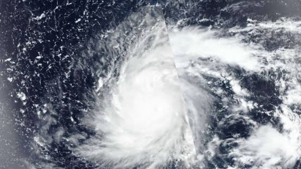
Taipei/Beijing: Typhoon Dolphin has emerged as a major weather threat for East Asia, forcing Taiwan and China to activate emergency preparedness measures as the powerful storm moves closer to the region. The typhoon has triggered heavy rainfall warnings, strong wind alerts, flight disruptions and a fresh dispute between Beijing and Taipei over maritime control measures in the Taiwan Strait.
Typhoon Dolphin, the 13th typhoon of the year, entered China’s 24-hour warning zone late Friday, prompting authorities to upgrade disaster response operations across several coastal provinces. Weather agencies have warned of torrential rain, flooding risks, landslides and dangerous wind conditions as the storm approaches the eastern coastline.
According to Taiwan’s Central Weather Administration (CWA), the centre of Typhoon Dolphin was located around 510 kilometres east-northeast of Taipei on Saturday morning. The storm was moving west-northwest at a speed of around 10 to 14 kilometres per hour, carrying maximum sustained winds of nearly 126 kilometres per hour. Meanwhile, Chinese weather authorities reported that the storm was located around 600 kilometres east of Wenzhou in Zhejiang Province late Friday and was moving slowly westward at a speed of 5 to 10 kilometres per hour.
Meteorologists have classified Dolphin as a severe typhoon. Early Saturday, the storm was positioned over the southern part of the East China Sea, carrying maximum sustained winds of nearly 45 metres per second, equivalent to force 14 on the Beaufort scale. The central pressure of the system was recorded at around 950 hectopascals, indicating a strong tropical cyclone. Weather experts said the storm’s intensity may remain stable or increase slightly before making landfall. After reaching the Chinese coastline, Typhoon Dolphin is expected to gradually weaken while moving inland.
Taiwan is expected to witness the closest approach of Typhoon Dolphin on Saturday night or Sunday, according to the Central Weather Administration. Although the storm has shown signs of weakening, officials warned that its outer rain bands could bring intense rainfall to northern Taiwan before spreading to other parts of the island.
The heaviest rainfall is expected from Saturday night through Sunday, with authorities issuing heavy rain alerts in several vulnerable regions. The warning covers Keelung City, the North Coast area, mountainous regions of Taipei, New Taipei and Taoyuan cities, Hsinchu and Miaoli counties, along with mountainous areas of Taichung.
Weather authorities said some areas could receive more than 80 millimetres of rainfall within 24 hours, while hourly rainfall may cross 40 millimetres during intense spells. Residents in flood-prone and mountainous regions have been advised to remain cautious due to possible flash floods, landslides, road blockages and sudden changes in weather conditions.
The CWA has also issued strong wind warnings for northern Taiwan and parts of southern Taiwan. Average wind speeds are expected to remain between 39 and 49 kilometres per hour, with stronger gusts possible in coastal and elevated areas.
After passing near Taiwan, Typhoon Dolphin is expected to move towards China’s southeastern coast and could make landfall between Zhoushan in Zhejiang Province and Fuding in Fujian Province from Saturday night to early Sunday. China has intensified its disaster management response as the storm approaches. The State Flood Control and Drought Relief Headquarters upgraded the flood and typhoon prevention emergency response level for Zhejiang and Fujian provinces.
The Ministry of Emergency Management also activated a national geological disaster emergency response due to the increased risk of landslides and other weather-related incidents in parts of Zhejiang and northern Fujian. The China Meteorological Administration issued an orange typhoon warning along with a blue severe convective weather warning, directing local authorities to strengthen monitoring, early warning systems and emergency rescue preparations.
Coastal provinces have suspended ferry services, stopped construction activities in vulnerable areas, evacuated fishermen from risky locations and deployed drones for maritime surveillance. Rescue teams have also inspected water rescue equipment, protective gear and emergency response systems to handle possible flooding and storm-related incidents. Typhoon Dolphin is expected to become the fourth major typhoon to impact China during this summer season.
The impact of Typhoon Dolphin is already being felt in China’s aviation sector, with multiple flight cancellations and delays reported across eastern cities. Major disruptions have been reported at airports in Shanghai, Ningbo, Wenzhou, Taizhou and Hangzhou.
Shanghai Pudong International Airport witnessed significant disruption, with several departing and arriving flights delayed or cancelled due to worsening weather conditions. Flight tracking data showed that hundreds of scheduled flights were affected, forcing airlines to offer flexible travel options, including ticket changes and cancellation facilities for passengers.
Hangzhou Xiaoshan International Airport also reported several cancelled flights involving both arrivals and departures. China’s National Meteorological Centre warned that Shanghai and Zhejiang Province could enter the typhoon’s dangerous semicircle, a region where cyclones generally produce stronger winds and heavier rainfall. Authorities have predicted extremely heavy rainfall in these areas as the storm approaches.
Apart from the weather emergency, Typhoon Dolphin has sparked a fresh dispute between Taiwan and China over shipping restrictions in the Taiwan Strait. Chinese authorities announced traffic control measures for vessels travelling through parts of the strategic waterway, citing safety concerns due to the approaching storm.
Ships were instructed to move towards safer waters and follow directions issued by maritime management authorities. Taiwan objected to China’s move, stating that Beijing does not have authority over international shipping routes in the Taiwan Strait. Taiwan’s Mainland Affairs Council criticised the decision and said maritime activities should be managed according to international rules and maritime norms.
The Taiwan Strait is one of the world’s busiest shipping corridors and handles a large volume of regional and international trade. The waterway is also a sensitive geopolitical zone due to long-running differences between Beijing and Taipei over sovereignty issues.
Taiwan’s Coast Guard said it has not observed unusual movements by Chinese vessels in the region amid the typhoon situation. The agency advised cargo ships and commercial vessels operating in the Taiwan Strait to remain alert and report any suspicious communication, broadcast interference or unauthorised instructions. Officials said necessary measures would be taken to protect maritime safety and maintain freedom of navigation in the important international waterway.
Typhoon Dolphin has created multiple challenges for Taiwan and China, affecting aviation services, maritime operations, transportation networks and public safety. Authorities across the region are closely monitoring the storm’s movement and have activated emergency response systems to deal with possible flooding, infrastructure damage and travel disruptions. Residents, fishermen and travellers have been advised to follow official weather updates as Typhoon Dolphin moves towards China’s eastern coast and gradually weakens after landfall.
While several regions are preparing for heavy rain and strong winds, some parts of Taiwan may continue to experience extreme heat due to the foehn wind effect. Weather experts said descending southeasterly winds from mountainous areas could push temperatures above 38 degrees Celsius in Yilan and Hualien counties. Taitung County in eastern Taiwan, along with Chiayi County and Tainan City in southern Taiwan, may record temperatures above 36 degrees Celsius. The unusual combination of heavy rainfall, strong winds and high temperatures has created complex weather conditions across the island.

