J&K Weather Alert: Heavy Rain Warning Issued, Flash Flood Risk Rises Across Regions

The MeT department has issued a four-day rain alert from August 16 to 19, warning of heavy showers, flash floods, landslides and possible travel disruptions. Tourists and residents in vulnerable areas have been advised to stay alert as intense rainfall is expected across the region.

Post Published By: Subhash Raturi
Updated : 16 August 2026, 6:47 PM IST
google-preferred
Jammu: Jammu and Kashmir is set to witness a fresh spell of rain and thunderstorms as the Meteorological Centre Srinagar has issued a four-day weather alert till August 19, with chances of intense showers in several districts. The warning has gained attention as hilly areas remain vulnerable to sudden floods, mudslides and road blockages caused by short-duration heavy rainfall.

The fresh weather advisory has raised concerns among residents, tourists and commuters as several hilly regions remain at risk of sudden weather-related disruptions. The Jammu division is expected to witness stronger rainfall activity, while isolated parts of the Kashmir Valley may also experience heavy showers.

J&K Weather Update: Four-Day Rain Alert Issued Till August 19

Jammu and Kashmir is likely to experience light to moderate rain and thunderstorms at many places between August 16 and 19, according to the latest forecast issued by the Meteorological Department.

Weather officials have warned that some areas may receive brief but intense rainfall spells, especially during morning and afternoon hours. The Jammu division is expected to witness stronger rain activity, while isolated parts of the Kashmir Valley may also experience heavy showers.

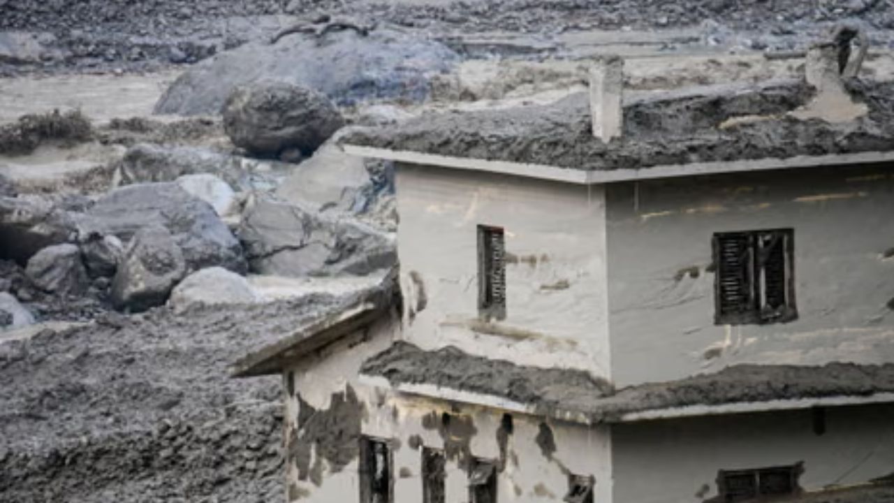
The department has cautioned that intense rainfall within a short period can trigger flash floods, landslides, mudslides and waterlogging, particularly in vulnerable and low-lying areas.

The latest advisory has raised concerns in mountainous regions where heavy rain often creates dangerous conditions within a short time. Authorities have advised people living near rivers, streams and landslide-prone locations to remain cautious.

Commuters and tourists travelling through hilly routes have been urged to avoid unnecessary journeys during periods of heavy rainfall. Officials have also warned about possible disruptions caused by reduced visibility, falling debris, road damage and shooting stones along vulnerable mountain roads.

The Jammu division is expected to remain the most sensitive region during this rainfall spell. Districts including Jammu, Reasi, Udhampur, Rajouri, Poonch, Samba and Kathua may witness intense rain activity during the forecast period.

The weather department has advised local administrations to remain prepared for emergency situations, especially in areas that have previously witnessed flash floods and landslides.

Rainfall Recorded Across Several Parts of J&K

Several areas of Jammu and Kashmir have already received significant rainfall in the past 24 hours. Kulgam recorded the highest rainfall at 55.5 mm, followed by Pahalgam with 29.6 mm and Katra with 20.8 mm.

The rainfall provided temporary relief from hot weather conditions in some parts of the region but also increased concerns over water accumulation and weather-related hazards. Despite rains, temperatures remained above normal in several areas. Srinagar recorded a maximum temperature of 32 degrees Celsius, around 2.6 degrees above normal, while the minimum temperature was recorded at 18.5 degrees Celsius.

Gulmarg remained the coolest location with a maximum temperature of 21.4 degrees Celsius, while Pahalgam recorded 25.6 degrees Celsius. In Jammu, the maximum temperature was recorded at 32.5 degrees Celsius, while Katra, Banihal and Bhaderwah recorded 28.6 degrees Celsius, 29.7 degrees Celsius and 27.8 degrees Celsius respectively.

The rainfall is likely to continue beyond the current four-day alert period. The Meteorological Department has predicted scattered light to moderate rain and thunderstorms at some places between August 20 and August 22, mainly during early morning and late afternoon hours.

Officials have advised people to continue monitoring weather updates as localised intense showers can create sudden flood-like situations even when overall rainfall remains moderate.

Advisory Issued for Residents and Tourists

Residents in low-lying and flood-sensitive areas have been advised to stay alert and follow official safety instructions. People have been asked to avoid crossing swollen streams, rivers and waterlogged roads during heavy rainfall. Tourists travelling through mountain routes have also been advised to plan their movement carefully and avoid landslide-prone areas.

Disaster management teams and local authorities are monitoring the situation to prevent accidents and ensure timely response during emergencies. The latest J&K weather alert highlights the growing risks associated with short-duration intense rainfall events in Himalayan regions.

While monsoon showers provide relief from heat and support water resources, sudden heavy downpours often create challenges due to the fragile terrain, steep slopes and vulnerable infrastructure. The next few days will remain crucial as authorities continue monitoring rainfall patterns and preparing for possible weather-related emergencies across Jammu and Kashmir.

Location :  New Delhi

Published :  16 August 2026, 6:44 PM IST

Related News

No related posts found.

Advertisement