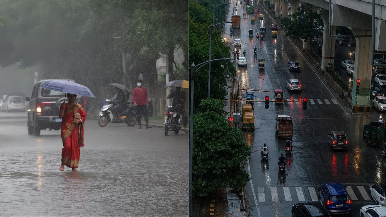
Delhi-NCR witnessed late-night rain and thunderstorms, bringing cooler conditions to the national capital and neighbouring cities. (Img: X)
New Delhi: Delhi-NCR witnessed a dramatic weather shift late Saturday night as rain, thunderstorms, gusty winds and isolated reports of hail swept across the national capital and neighbouring cities, bringing cooler conditions after several days of relatively warm weather. Showers were reported in Delhi, Noida, Ghaziabad, Gurugram and Faridabad, while the overnight spell also raised hopes of temporary relief from worsening air pollution.
However, the India Meteorological Department (IMD) has forecast predominantly dry weather for Delhi on Sunday, October 25, with mainly clear skies expected during the day. While the overnight showers have brought a noticeable change in conditions, the broader weather outlook remains dynamic, with a developing system over the Bay of Bengal raising the possibility of heavy rainfall, thunderstorms and strong winds across several states in the coming days.
The contrasting weather conditions across northern, eastern and southern India have placed multiple regions under close meteorological observation, with residents advised to monitor the latest forecasts and local weather alerts.
Delhi recorded a temperature of around 18°C at the Safdarjung weather station during the early hours of Sunday, October 25. Weather dashboard readings at approximately 5:30 am indicated humidity of 98 per cent, negligible wind speed and misty conditions.
According to the IMD forecast, the maximum temperature is expected to range between 31°C and 33°C, while the minimum may remain between 16°C and 18°C. Mainly clear skies are likely during the day, accompanied by strengthening surface winds in the afternoon.
The overnight spell marked a change in the weather across the National Capital Region (NCR), where rain and gusty winds brought temporary respite from relatively warmer conditions. However, residents should not assume that the cooler conditions will persist throughout the day, as temperatures are expected to rise under clearer skies.
The IMD's forecast also indicates that Delhi, Haryana and Chandigarh are likely to experience predominantly dry conditions on Sunday, despite the overnight weather disturbance.
Delhi's air quality showed an improvement following the overnight weather activity, although pollution remained a concern across several monitoring locations. The city's Air Quality Index (AQI) was reported at 230 on Friday before improving to 191 on Saturday.
An early-morning dashboard reading on Sunday showed the AQI at 181, placing it in the moderate category under India's national AQI classification. However, the improvement at the city level does not mean that pollution has disappeared. Monitoring stations across Delhi continued to record elevated readings, with several locations remaining in the poor category.
Jahangirpuri registered an AQI of 276, while Punjabi Bagh recorded 251 and Bawana 246. Narela reported an AQI of 244, and Rohini stood at 239. Other locations, including Alipur, IIT Delhi, Patparganj and Chandni Chowk, also reported elevated pollution levels in the dashboard data cited in the available reports.
Rainfall and stronger winds can influence ambient air quality by removing some airborne particles and dispersing pollutants. Nevertheless, the extent of any improvement depends on rainfall intensity, wind direction, atmospheric stability, emissions and subsequent weather conditions.
The Air Quality Early Warning System for Delhi indicated that air quality could remain in the poor category between October 25 and October 27, with conditions potentially fluctuating between poor and moderate over the following days.
This suggests that the recent improvement may be temporary. Residents, particularly children, older adults and people with respiratory sensitivities, should continue checking local AQI readings and follow appropriate precautions when pollution levels rise.
While Delhi is expected to remain largely dry, a developing weather system over the Bay of Bengal has emerged as a major focus of the IMD's forecast for the coming days.
According to the supplied meteorological outlook, a low-pressure area over the east-central and adjoining southeast Bay of Bengal was expected to intensify into a deep depression by October 25 and potentially develop into a cyclonic storm by the morning of October 26.
The system is forecast to move northwestwards towards the northern Andhra Pradesh and southern Odisha coasts, with the possibility of approaching the coastline around the morning of October 28.
The developing system has been identified in the supplied forecast as Cyclone Arnab, a name proposed by Bangladesh. Its eventual intensity, trajectory and landfall implications will depend on further atmospheric developments and updated IMD assessments.
The possibility of a cyclonic storm has prompted heightened attention across vulnerable coastal regions, where heavy rainfall, squally winds, rough seas and localised flooding could disrupt normal activities.
North coastal Andhra Pradesh and parts of Odisha could experience heavy to very heavy rainfall as the Bay of Bengal system approaches the eastern coastline.
The forecast indicates that rainfall activity may intensify between October 27 and October 29, with isolated areas potentially experiencing extremely heavy downpours. Such conditions can increase the risk of waterlogging, flash flooding in vulnerable locations, transport disruptions and damage to standing crops.
Odisha has reportedly stepped up preparations in anticipation of the potential weather system. Chief Minister Mohan Charan Majhi said the state government had reviewed the possible impact and assigned responsibilities to different departments, with the objective of preventing casualties.
Preparedness measures and timely dissemination of weather warnings are particularly important in coastal districts, where strong winds and rough sea conditions can create additional risks for fishing communities and maritime operations.
Fishermen have been advised to avoid venturing into affected sea areas in accordance with official advisories. Residents in vulnerable coastal locations should follow instructions issued by local administrations and disaster management authorities.
The storm's projected route and intensity may change as the system develops, making updated forecasts essential for assessing the likely impact.
Southern India is also expected to witness significant rainfall activity, with the IMD forecasting heavy to very heavy rainfall and isolated extremely heavy downpours over parts of Kerala and Mahe, Tamil Nadu, Puducherry and Karaikal.
In Tamil Nadu, the forecast covers the Nilgiris, Villupuram, Cuddalore, Mayiladuthurai, Nagapattinam, Tiruvarur, Thanjavur, Kallakurichi, Tiruvannamalai and Coimbatore, among other areas. Chennai, Tiruvallur, Chengalpattu and Kancheepuram are also among the locations highlighted in the available forecast.
Heavy rainfall is additionally possible at isolated places over the Andaman and Nicobar Islands, Lakshadweep and south interior Karnataka.
The rainfall threat comes amid active weather conditions across the southern peninsula, where intense downpours can trigger localised flooding, disrupt road traffic and affect low-lying areas.
Residents are advised to monitor district-level forecasts, avoid waterlogged roads and exercise caution around overflowing drains and streams during periods of intense rainfall.
The developing Bay of Bengal system could also influence weather conditions across eastern and parts of central India. Kolkata is forecast to receive light to moderate rainfall, while coastal areas of West Bengal may experience squally winds. Isolated heavy rainfall is possible in some districts between October 28 and October 30.
Parts of Bihar, Jharkhand and Chhattisgarh may also receive isolated heavy rainfall on October 28 and October 29, according to the supplied IMD outlook.
Thunderstorms accompanied by lightning and gusty winds are expected in several regions, including the Andaman and Nicobar Islands, east Madhya Pradesh, Tamil Nadu, Puducherry and Karaikal. Gusty winds are also possible in parts of Andhra Pradesh, Kerala, Mahe and Lakshadweep.
The IMD has also warned of squally weather over parts of the Bay of Bengal and around the Andaman Islands, with wind speeds of 50–60 kmph and gusts potentially reaching 70 kmph in some areas. These conditions may affect maritime activities and small vessels, reinforcing the need to follow official warnings and avoid unnecessary exposure during severe weather.
For Delhi-NCR, the immediate outlook points towards predominantly dry weather on Sunday after the late-night rain and thunderstorms. The forecast of mainly clear skies suggests that the overnight spell may not develop into a prolonged rainfall event over the capital.
Air quality, however, remains a separate concern. Although the early-morning AQI reading improved to 181, several neighbourhoods continued to record pollution levels in the poor category. The outlook for October 25–27 also indicates that pollution could remain elevated despite the recent improvement.
Across the country, the developing Bay of Bengal system is likely to be the more significant weather concern in the coming days, particularly for coastal Andhra Pradesh, Odisha, Tamil Nadu and Kerala, as well as parts of eastern India.
Residents should rely on the latest IMD bulletins and local administration advisories rather than treating preliminary projections as confirmed storm-track or landfall information.
The latest weather developments underline the sharp contrast between temporary cooling in Delhi-NCR and the growing possibility of intense rainfall across other parts of India. While the national capital prepares for a largely dry Sunday, several states may need to remain alert to changing rainfall patterns, thunderstorms and potentially disruptive winds.

