 English
 English

The Moment the Himalayas Unleashed Their Fury, Captured Seconds Before Disaster
Kathmandu: A chilling drone video has revealed the moment a massive Himalayan glacier collapsed before unleashing one of the deadliest flood disasters in Nepal and Tibet. The footage, accidentally recorded by a Chinese photographer, shows a huge section of ice and mountain rock breaking away from the slopes of Langtang Lirung peak, providing critical clues about what triggered the catastrophic flash floods.
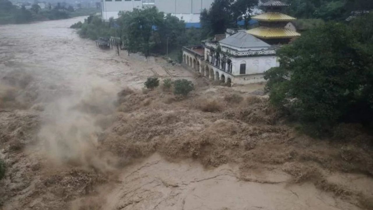
The dramatic visuals show the snow-covered mountain suddenly giving way, followed by enormous clouds of dust, ice and debris spreading across the Himalayan landscape. The collapse sent a powerful wave of rocks, mud, glacier ice and water rushing towards the valleys below, eventually causing destructive flooding along the Bhotekoshi and Trishuli river systems.
The video has gone viral because it captured one of the rare moments when a major geological disaster was recorded as it unfolded, offering scientists valuable evidence to study the cause behind the Nepal flood tragedy.
The glacier collapse occurred near Langtang Lirung, one of Nepal’s highest peaks, located at an elevation of more than 7,200 metres along the Nepal-China border.
Experts analysing drone footage and satellite images believe a massive portion of the mountain slope collapsed, sending an enormous ice-rock avalanche thousands of feet downward. The impact created a powerful surge of debris that entered nearby rivers and transformed them into destructive flood channels.
The collapsing section reportedly created a massive scar on the mountainside, with estimates suggesting that the fallen glacier area was nearly 2,000 feet wide. The falling mass carried huge amounts of rock, ice and sediment, increasing the intensity of the floodwaters that later moved through Himalayan settlements.
The glacier-triggered disaster struck on August 26, causing widespread destruction across Nepal’s mountainous regions and parts of Tibet.
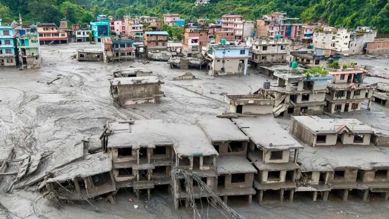
The sudden flood surge damaged homes, roads, bridges and communication networks, leaving several communities cut off from the outside world. Rescue teams have been working in extremely difficult conditions as landslides, heavy rainfall and damaged infrastructure continue to slow operations.
Hundreds of people have lost their lives, while thousands remain missing after the devastating floods swept through river valleys. Authorities fear that the final impact could be much higher as search operations continue in remote areas.
The rare video has become an important piece of evidence for researchers studying the disaster. Scientists are using drone visuals, satellite imagery and geological data to understand how a glacier collapse transformed into a massive flash flood.
The powerful impact of the collapse was initially detected through seismic activity. Monitoring agencies recorded unusual ground vibrations similar to an earthquake, but further analysis suggested that the signals were caused by the massive ice and rock movement.
Researchers believe studying such events can help improve early warning systems and disaster prediction methods in vulnerable Himalayan regions.
The disaster has highlighted the increasing risks faced by communities living in Himalayan valleys. Experts have warned that rising temperatures, glacier retreat and unstable mountain slopes are making high-altitude regions more vulnerable to sudden disasters.
Glacier collapses, landslides and glacial lake outburst floods have become major concerns across the Himalayan belt, where millions of people live near rivers originating from melting glaciers.
The Nepal tragedy has once again raised questions about climate change, mountain monitoring systems and the need for stronger disaster preparedness.
The latest disaster comes after several major glacier-related tragedies in recent years. In Uttarakhand in 2021, a massive rock and ice avalanche from Ronti Peak triggered devastating floods in the Dhauliganga and Rishi Ganga rivers, destroying a hydropower project and killing or leaving around 200 people missing.
In 2023, a rock collapse into South Lhonak Lake in Sikkim caused a devastating glacial lake outburst flood that damaged bridges, buildings and critical infrastructure. In 2025, a major glacier collapse in Switzerland’s Alps buried parts of the village of Blatten, highlighting that glacier instability is becoming a global challenge.
Scientists and disaster management agencies are continuing to analyse the drone footage and satellite data to understand the exact sequence of events behind the Nepal floods. The findings could help improve Himalayan disaster warning systems, glacier monitoring technology and emergency response planning.